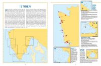
In this guide you will find maps of all the Croatian harbours, marinas, village harbours and piers, quays and bays which are sailing destinations, where you can moor or anchor for the night. In contrast to other pilots, we have not chosen destinations according to size, but have selected places which can provide shelter, even if only for a six-metre boat. This means that this book will be of use not only to sailors and all who decide to set out on a longer cruise, but also to the owners of the large charter fleets housed in Croatian harbours. The texts accompanying the maps describe the main characteristics of the mooring or anchorage, the most frequent winds, the type of sea bed, orientation points and warnings. Since many sailors arrive in Croatia via the northern harbours of Italy, or via Otranto, we have included two short supplements showing maps of the most important marinas and quays on the Slovenian and Montenegrin coasts.
Customers who bought this product also bought the following products:
 | 2600040 Kulinarischer Küstenatlas Triest-DubrovnikA culinary guide from Triest to Dubrovnik with satellite images and nautical charts 39,90 EUR (10 % VAT incl. excl. Shipping costs) |
 | 410019 - Silba - PagCroatian Nautical Chart 20,00 EUR (10 % VAT incl. excl. Shipping costs) |
 | 410020 - Dugi Otok - ZadarCroatian Nautical Chart 20,00 EUR (10 % VAT incl. excl. Shipping costs) |
 | 410021 - Sibenik - SplitCroatian Nautical Chart 20,00 EUR (10 % VAT incl. excl. Shipping costs) |
 | 2130002 - Kroatien und Slowenien, Koper bis Split (German)(German) Kroatien und Slowenien, Koper bis Split 34,90 EUR (10 % VAT incl. excl. Shipping costs) |
 | 410016 - Pula - KvarnerCroatian Nautical Chart 20,00 EUR (10 % VAT incl. excl. Shipping costs) |

